Madrid · Europe · USA

Advanced Drone Solutions
for Cities, Land
and Innovation

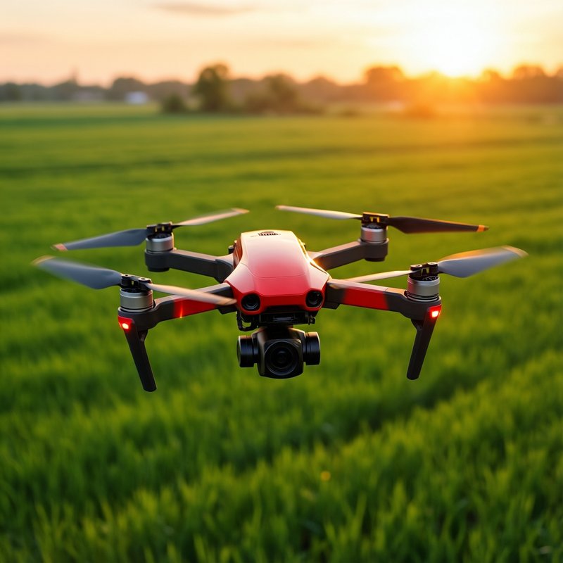
Altamira Drones delivers high-value drone services for urban environments, technical inspection, agriculture, livestock management and applied R&D, operating from Madrid across Europe and the USA.

Scroll

What we do

Technology-driven drone operations for real-world challenges

Altamira Drones is a Madrid-based drone company focused on delivering advanced aerial services for both urban and rural environments. We combine drone operations, visual intelligence, geospatial data and innovation-driven development to support technical inspections, photogrammetry, agricultural analysis, land management and next-generation digital solutions.

Our work goes beyond aerial imagery. We develop data-oriented and innovation-led services designed to support decision-making, operational efficiency and sector-specific applications in architecture, infrastructure, agriculture and livestock.

01 / Urban Solutions

Aerial intelligence for the built environment

Altamira Drones provides advanced drone services for urban environments, buildings, technical assets, architecture, engineering and infrastructure-related operations. We help capture visual and geospatial information efficiently, safely and with a strong technical focus.

Technical Inspections

Drone-based visual and technical inspections for buildings, roofs, facades, structures and hard-to-access assets. Detailed observation, technical documentation and improved inspection workflows.

Photogrammetry

Aerial data capture for photogrammetric processing, spatial documentation and visual analysis of urban and built environments. Orthomosaics, 3D models and topographic support.

Building & Asset Observation

Targeted aerial observation of buildings, envelopes, structural surfaces and site conditions for technical review and operational support.

Construction Progress

Periodic aerial documentation for monitoring the evolution of projects, sites and interventions over time. Visual records for teams and stakeholders.

Architecture & Engineering

Drone services designed to support architects, technical consultants, engineers and planners with reliable visual and territorial information.

Site & Land Visualization

Aerial overviews of plots, developments, technical sites and urban land to improve understanding, planning and presentation.

Preventive Maintenance

Visual detection of apparent issues, surface anomalies and key points requiring closer technical assessment for maintenance planning.

Heritage & Complex Buildings

Support for the observation and documentation of architecturally complex, sensitive or hard-to-access structures and historical buildings.

We help urban and technical sectors work with better visibility, faster access to information and more efficient aerial documentation.

02 / Agriculture & Livestock

Precision aerial systems for land and livestock

Altamira Drones develops drone-based solutions for agriculture and livestock operations, combining aerial observation, territorial analysis, multispectral workflows and innovation-oriented tools to improve field management and operational decision-making.

Agriculture

Aerial Product Application

Operational aerial application services adapted to the needs and technical framework of each project, improving efficiency and coverage.

Multispectral Analysis

Generation and interpretation of aerial data using indexes such as NDVI, SAVI, TSAVI and other spectral indicators for vegetation and crop analysis.

Soil & Parcel Mapping

Drone-based mapping to support parcel organization, land analysis, zoning, sampling strategies and operational planning.

Crop Monitoring

Visual and data-driven field monitoring to identify variability, observe development patterns and improve situational awareness across agricultural parcels.

Early Detection Support

Aerial review of conditions that may indicate stress, irregular development or issues requiring agronomic follow-up and validation.

Irrigation & Resource Support

Aerial observation to help identify irregularities and support review of land behavior, irrigation patterns and field heterogeneity.

Livestock

Animal Location & Counting

Aerial support for locating animals, observing spatial distribution and assisting livestock monitoring over large or complex areas.

Grazing & Parcel Supervision

Drone observation of pasture use, land occupation, enclosure conditions and distribution patterns across livestock areas.

Infrastructure Review

Visual inspection of fences, water points, feeding zones and other operational infrastructure linked to livestock activities.

Behaviour Observation

Aerial support for observing movement patterns, grouping, dispersion and other visible dynamics relevant to field supervision.

Large-Area Monitoring

Rapid visual review of extensive rural areas for more agile operational oversight and situational awareness.

Digital Management Support

Drone-enabled workflows that integrate with broader digital systems for livestock and land management.

Our approach combines aerial capability, operational understanding and innovation to support more efficient, intelligent and scalable agricultural and livestock management.

03 / Innovation

R&D at the core

We see drone technology not only as a tool for aerial capture, but as a platform for developing smarter systems for analysis, monitoring, management and applied decision support.

Our objective is to create value beyond imagery by combining drone operations, applied data, technical interpretation and digital development into useful real-world solutions. This innovation mindset is especially relevant in sectors where efficiency, field visibility, land intelligence and operational responsiveness are critical.

R&D Focus Areas

Agriculture technology and precision farming tools
Livestock management and monitoring solutions
Parcel intelligence and territorial digitalization
Multispectral analysis workflows and spectral data
Aerial data interpretation and analytics
Software-oriented operational support systems

We aim to contribute to the next generation of drone-enabled solutions for agriculture, livestock, land and technical operations.

04 / About

About Altamira Drones

Altamira Drones is a Madrid-based company specialized in professional drone services for urban and rural environments.

We work across technical inspection, aerial observation, photogrammetry, agriculture, livestock and geospatial support, with a clear commitment to innovation and applied technology.

Our approach combines operational capability, technical vision and international ambition. We develop services for both city-based and field-based applications, while also investing in R&D and digital solutions that expand the role of drones in real operational environments.

From Madrid, we operate with a broad outlook across Europe and the USA, building a profile centered on quality, agility, innovation and practical value.

Madrid

Headquarters

Europe

Operating area

USA

Operating area

05 / Contact

Get in touch

For service inquiries, technical collaborations or partnership opportunities, contact Altamira Drones directly.

Phone / WhatsApp

+34 638 099 208 +34 610 485 116

Address

Calle Hermosilla, 48
Piso 1, Puerta DC
28001 Madrid, Spain

Languages: English and Spanish · Operating area: Europe and USA